¡Consigue esta oferta! Llama ahora.
Hable con un especialista en planes de protección de vehículos y obtenga $300 apagado cualquier nuevo contrato al instante.
Llamar 866-678-4172
o escanea el código a continuación


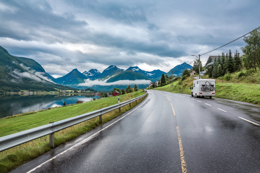
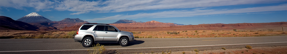
Alemania puede tener la Autobahn, pero Estados Unidos creció alrededor del automóvil. Las grandes extensiones de tierras agrícolas atravesadas por carreteras e interestatales son tan omnipresentes como cualquier horizonte famoso. La relación estadounidense con los viajes por carretera no surgió de la noche a la mañana. Empresas enteras, avances mecánicos y organizaciones gubernamentales tuvieron que aparecer con el tiempo. Ya sea atravesando el país o a un par de horas de casa, hay mucho que reconocer sobre la forma en que los viajes por carretera han moldeado a Estados Unidos.
Las autopistas surgieron como una forma de facilitar los viajes por carretera. El sistema de autopistas de Estados Unidos se construyó en 1926, cuando había una gran cantidad de automóviles en las calles. En los buenos tiempos, las calles eran horribles incluso en las zonas urbanas, y los caminos rurales eran poco más que senderos de tierra rellena o pistas de dos carriles llenas de lodo a través de campos y bosques. Los fabricantes de automóviles tuvieron que hacer campaña para mejorar las condiciones de conducción.
El sistema de autopistas fue parte de ese esfuerzo. En primer lugar, la administración marcó las rutas principales, haciendo que las rutas fueran menos exigentes. Las asignaciones de carreteras se establecieron en un diseño de matriz. Las rutas impares van de norte a sur y las pares de este a oeste. La famosa Ruta 66 se estableció como parte del sistema. Los vagabundos utilizaron la 66 durante el Dust Bowl para llegar a California.
La red de autopistas interestatales se creó en el sentido inverso para evitar el desorden. Con la Ley de Ayuda Federal para Carreteras de 1956, el presidente Eisenhower prometió introducir otra era de calles más seguras con menos afluencia de automóviles.
La Ley de Ayuda Federal impulsó un enorme desarrollo en la construcción de carreteras, en particular en las rutas para el transporte interestatal completo. A partir de 2013, la red interestatal incluía 47.856 millas de carreteras, lo que la convirtió en la segunda más larga del mundo después de China.
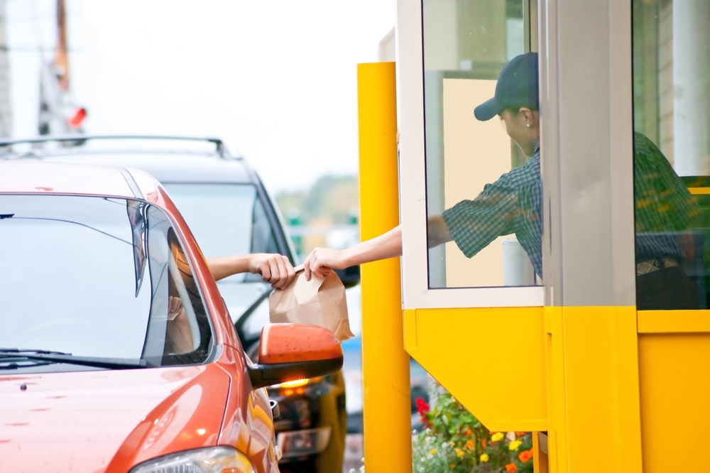
Cuando estás fuera de casa y conduces a buen ritmo, lo que no necesitas hacer es detenerte a comer algo. Afortunadamente, existen establecimientos de comida rápida que se agrupan en las salidas de las carreteras interestatales de Estados Unidos. Además, no necesitas salir del coche.
Aunque en los años 50 la gente ya sabía lo que era comer en el coche gracias a los autoservicios, los autoservicios eran más poco habituales. En general, la gente cree que McDonald's fue el primer restaurante que lo intentó, pero el posible gigante de la comida rápida se animó a adoptarlo más tarde. Red's Giant Hamburg fue el primer lugar en ofrecer hamburguesas a través de una ventanilla a los conductores hambrientos. Abrió en 1947 en la Ruta 66 en Springfield, Missouri.
Red's cerró en 1984, pero el drive-thru más antiguo que ha estado en funcionamiento sigue en activo después de 67 años. En 1948 abrió el primer In-n-Out en Baldwin Park, California. Era un restaurante con drive-thru, con un sistema de radio y sin zona de espera ni asientos. Cadenas más pequeñas como Jack-in-the-Box y Wendy's se hicieron con la ventanilla de drive-thru de inmediato, pero McDonald's no se sumó a la moda pasajera hasta la década de 1970.
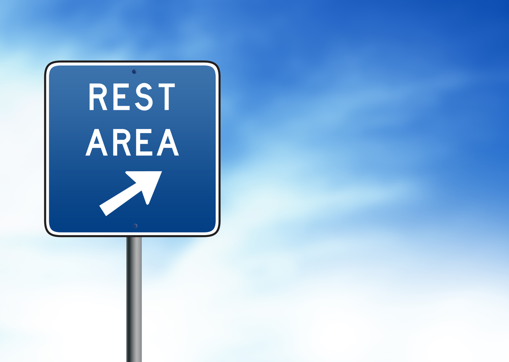
Prepárese para la gran dramatización del contexto histórico de las paradas de descanso en la carretera. La Ley de Ayuda Federal para Carreteras de 1956 no solo estableció la estructura de las autopistas, sino que también ayudó a desarrollar el sistema de paradas de descanso que bordean las carreteras hasta el día de hoy. Los federales consideraban que las áreas de descanso eran una medida de seguridad imprescindible, ofreciendo a los conductores cansados un respiro de horas de viaje. El proyecto requería que las áreas de descanso se mantuvieran y administraran con baños y áreas para picnics. Lo que el proyecto no indicó es cómo los planificadores innovadores podrían estar con las paradas de descanso. Estas paradas de descanso pueden ser el principal contacto que los exploradores tuvieron con la cultura local a medida que avanzaban. Muchas están adaptadas a la zona en la que se encuentran, por ejemplo, los grandes tipis en los estados del suroeste. Todas contienen información básica sobre el estado y la zona circundante. Algunas se consideran grandes ejemplos de diseño de mediados de siglo y han creado una base de seguidores poco común.

Observa los mapas de locura que son naturales para cualquier persona que tuviera un libro de mapas de la AAA de rutas de cross country en 1918, antes de que la mayoría de las calles fuera de los límites tuvieran siquiera un número para nombrarlas. Los primeros mapas utilizables con avenidas con nombre aparecieron a fines del siglo XIX, pero eran para ciclistas, peatones y carruajes en grandes comunidades urbanas. La gente viajaba largas distancias en tren. Las calles fuera de los centros de población reales eran normalmente calles de tierra firme. Cuando Horatio Nelson Jackson completó el primer viaje por carretera de cross country en 1903, le tomó sesenta y tres días de viaje por terreno accidentado para ir de San Francisco a Nueva York.
A medida que los automóviles se convirtieron en algo más habitual, las calles y los mapas en mal estado se convirtieron en un problema cada vez mayor. La AAA se creó para gestionar el aspecto orientador de esos problemas. Junto con Automobile Blue Book Publishing Company, la AAA imprimió mapas que destacaban las calles "excelentes". Estos mapas a menudo incluían fotografías de las rutas para ayudar a los conductores a saber dónde se encontraban. Las fotografías seguían siendo un problema, ya que distinguir las calles por el entorno no tendría sentido si el escenario cambiaba. La AAA continuamente enviaba guías para descubrir qué rutas eran adecuadas para los automóviles. Los mapas mejoraron drásticamente cuando se institucionalizaron los nombres de las rutas y se comenzó a cambiar realmente la calle en la década de 1920.
Hemos recibido la información de su vehículo y nos comunicaremos con usted en breve con su cotización.
- O -
Comience a buscar un plan de cobertura ahora.

Estamos aquí para asegurarnos de que obtenga la protección EV más completa. Por eso nos hemos asociado con Xcelerate automático para ofrecerle una cobertura Tesla transparente y confiable.
¿Quiere que nos comuniquemos con usted acerca de la cobertura XCare para su Tesla?
Su protección es nuestra principal prioridad. Su cotización está en proceso y usted
recibirá un correo electrónico de confirmación en breve.

Hable con un especialista en planes de protección de vehículos y obtenga $300 de descuento en cualquier contrato nuevo al instante.
¡Llama y obtén un descuento de $300 en cualquier plan nuevo!
Al hacer clic en el botón, acepta que Endurance utilice tecnología automatizada para llamarlo, enviarle un correo electrónico y enviarle mensajes de texto utilizando la información de contacto anterior, incluido su número de teléfono móvil, si se proporciona, con respecto a la protección del automóvil o, en California, el seguro contra averías mecánicas. También acepta el Endurance política de privacidad y Términos y condiciones. El consentimiento no es una condición de compra y puede retirar el consentimiento en cualquier momento. Se pueden aplicar tarifas por mensajes y datos.
Hable con un especialista en planes de protección de vehículos y obtenga $300 apagado cualquier nuevo contrato al instante.
Llamar 866-678-4172
o escanea el código a continuación

Simplemente complete la información a continuación y le daremos seguimiento rápidamente con su cotización gratuita y sin compromiso.
Al hacer clic en el botón, acepta que Endurance utilice tecnología automatizada para llamarlo, enviarle un correo electrónico y enviarle mensajes de texto utilizando la información de contacto anterior, incluido su número de teléfono móvil, si se proporciona, con respecto a la protección del automóvil o, en California, el seguro contra averías mecánicas. También acepta el Endurance política de privacidad y Términos y condiciones. El consentimiento no es una condición de compra y puede retirar el consentimiento en cualquier momento. Se pueden aplicar tarifas por mensajes y datos.
Para hablar con un especialista en planes de protección de vehículos y guardar $300
Escanee el código a continuación


Alex ha trabajado en la industria de servicios automotrices durante más de 20 años. Luego de graduarse de una de las mejores escuelas técnicas del país, se desempeñó como técnico logrando la certificación de Maestro Técnico. También tiene experiencia como asesor de servicios y gerente de servicios. Leer más sobre alex